 This amazing area covers some 600 square miles and was originally a complete swamp with a few scattered areas where the land was high enough to support a settlement. Ely and Ramsey were both islands in the distant past . The photo above left is of the Holme Fen Posts -this pole was buried in1851 so that it's top was level with the ground at the time.This is now 13 feet above the ground caused by the gradual subsidence of the land due to the extensive drainage of the Fens and the shrinkage of the peat when it dried out. The photo above right is of a tyical canal or drain which supports the total system of draining water to the sea. Surrounding land is usually lower than the canal or other waterwat levels which means that water has to be pumped up from the land into these waterways when flooding occurs.
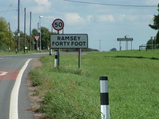
Ramsey Forty Foot is just a few minutes away from Ramsey and the name comes from the fact that the drain at this point is 40 foot wide!.
 Picture at right shows a typical road and canal which goes straight for several miles and is typical of the scenery in the area.
The Romans came to the Fens in 43 AD and established forts in the area. They did some work on drainage building canals,embankments and sea defences.But they left England in 410AD and by the 4th century all traces of Roman occupation had disappeared and the Fens reverted to floods and marshes.
Then there were the Viking invasions in the 8th century,the introduction of religious orders (and the commencement of building abbeys) and the Norman invasion of the 11th century.It was during this latter period that the building of Ely and Norwich Cathedrals was commenced.
In 1621 a dutchman Cornelius Vermuyden was brought to England with the brief to rehabilitate the Fens which he commenced to do by employing hundreds of labourers to dig massive canals, and to straighten the watercourses of several rivers with the aim of directing water flow more rapidly to the sea. In1637 the project was adjudged complete. However nature was not be so easily defeated, and severe rain and snow soon proved his plan needed more work.So in 1649 work started again with the extension of cuts and drains and the creation of the Ouse Washes a 4700 acre storage resevoir designed to hold flood waters until it was safe to release them into the river system.This was completed in1656 and the drainage of the Fens again declared finished. Not to be -the floods returned with a vengeance and it became apparent that Vermuyden had overlooked the nature of the land. The area that had been drained was 100% peat and peat is 90% water,and the draining had caused the peat to shrink and hence the land sank.
Windmills were introduced to pump the flood waters up to the now elevated waterways, but with limited success, and it was not until firstly, diesel powered and subsequently electric pumping capacity was introduced that things gradually improved. Even so there were catastrophic floods in the 20th century and millions of pounds were spent on Flood Control Strategy to reach the present day position. Even now there are still risks of flooding (there were major floods in1998-2003) and that, together with the continuing shrinkage of the land, poses ongoing problems for the Fens. In some places farmers are now ploughing into the clay subsoil where erosion has stripped the topsoil.
But a fascinating place to have lived in.
No comments:
Post a Comment